Nationwide AIS
Positional information of vessels is particularly crucial for collision avoidance. Conventionally, such a task was implemented using a radar system. Advancement of technologies particularly GPS and wireless and increase in waterway safety requirements respectively have made possible and demanded more effective and efficient solutions. AIS leverages on these new technologies to serve the purpose
The core function of the system is to identify, obtain positional and navigational related information of all the surrounding vessels.
AIS enhances and complements information provided by radar through more comprehensive information exchanges and communications. With the AIS installed, vessels are able to monitor the movement of multiple numbers of other AIS-equipped vessels and recognized them simultaneously regardless of visibility, thereby dramatically reducing the danger of ship collision.
Furthermore, ground facilities can obtain the ship-specific information necessary for automatic, real-time maritime traffic control. AIS will play an important role in ensuring navigational and operational efficiency in congested waterways.

The International Maritime Organisation (IMO) mandated the use of AIS by all vessels covered by the Safety of Life at Sea (SOLAS) convention (vessels over 300 tonnes or those carrying passengers) to be fitted by July 2004.

 The Automatic Identification System (AIS) was conceived as a means of communicating the position and identity of ships to shore and to other vessels. The idea is that each vessel is uniquely identifiable and each vessel can see who is around them. However, it has been accepted from an early stage that AIS would have other roles, including that of an Aid to Navigation (AtoN).
AIS enables the Maritime Administrations to ensure AtoNs are positioned in the correct place by reviewing vessel movements (see figures above). The use of AIS as an aid to navigation is developing in various ways and will be influenced by the changes taking place in other types of radio and radar aids and the trend towards integrated display technology. AIS as an Aid to Navigation will have safety benefits in the rapid marking of new hazards and providing relevant, unambiguous information to the mariner.
AIS can be used to provide:
- Synthetic AtoN
- AtoN AIS
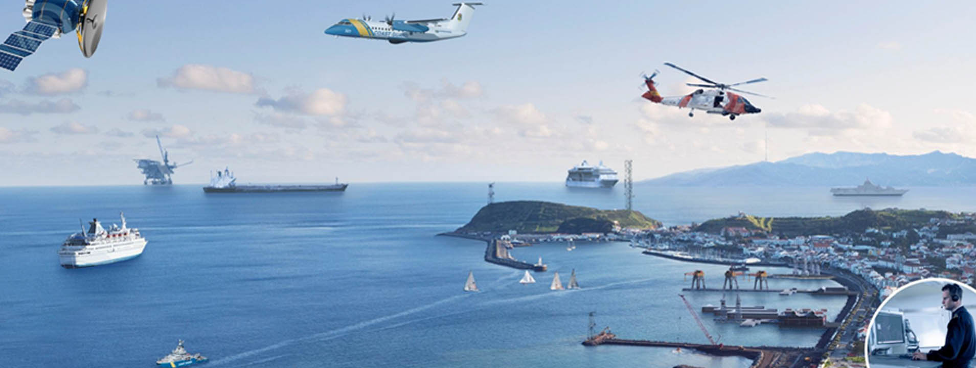
Automatic Identification System (AIS) applications:
- Ship to shore
- Ship to ship
- Aid to navigation
- Traffic monitoring

Information types, Capacity, and Operating mode
AIS station is capable of sending and receiving ship information such as identity, position, course, speed, ship particulars and cargo information to and from other ships, suitably equipped aircraft and shore. This is a significant enhancement to conventional radar technology that is only able to detect the presence of a ship or vehicle.
The primary operating mode for AIS will be autonomous ship-to-ship reporting. In this mode, each ship transmits its data to all other AIS-equipped ships within VHF range. AIS can handle over 2,000 reports per minute and updates information as often as every two seconds.

Underlying Technologies
Typically an AIS station consists of one VHF transmitter, two VHF receivers, one VHF DSC receiver, a standard marine electronic communications link, and sensor systems. Timing and positional information are derived from an integral Global Navigation Satellite System (GNSS) receiver.


")
")

